Ocotillo Hikers of Las Cruces
Photo Gallery


New in the Photo Gallery - "You're in the Movies"
Video highlights of past hikes are posted here but do not include current hikes -- only a sampling of past hikes. The videos are streamed in from YouTube to our site so you don't have to leave our site to view them. Simply click on the start button on each video for immediate viewing. Don't forget to turn up the sound so that you can hear your fellow hikers.
This week's videos are from our Wednesday, July15 hike to Percha Creek. Although the water was a little murky from the silt, those in the rear managed to negotiate their way upstream without too much difficulty. Below is a few video clip of our water adventure.
Percha Creek
Plan to join us this fall for another hike in Percha Creek
Robledo Hills - Trackways & Canyon Hike
A short video clip from our Trackways & Canyon hike Monday, July 20, 2009. The weather was hot, but not unexpected as has been the case for most of July. As usual, the Ocotillo Hikers didn't let 90 + temperatures stop them from venturing out to the trackways and a canyon just south of there for some off-trail hiking and scrambling.
Black Range, Gila Mtns.
Sawyers Peak Hike
July 25, 2009
Saturday, July 25, 2009, 13 Ocotillo Hikers from Las Cruces, NM carpooled to the Black Range of the Gila Mountains to hike the 9 mile Sawyers Peak trail. The summit is at an elevation of 9640 ft. We started at the trailhead at Emory Pass and made the round trip journey in 6 1/4 hrs. This time of year the forest was replete with abundant flora and fauna and the temperature hovered in the mid to upper 70's compared to the 100 degree temperatures waiting for us back in Las Cruces.
Available now
August 31, 2009. This canyon is located in the southern region of the Organ Mountains just east of Lost Canyon. The un-improved road leading to the canyon quickly vanishes and turns into a footpath that leads to a scrambling adventure to the top of the ridge at an elevation of 6200 ft. Although we did not make it to the top this time it was a challenging and fun hike for the 17 hikers that participated
Organ Mountains - Beyond the Lost Canyon Hike
Plan to join us next time as we attempt to make it all the way to the top
September 2, 2009. 15 hikers ventured up an old mining road near Bishops Cap to the mines at the saddle, then proceeded higher to a hilltop at an elevation of 5280 ft, (the mile-high hill) before scrambling down a ridge back to the cars. It turned out to be a challenging 2-mile hike for the Turtles but well worth the effort.
Organ Mountains - Bishops Cap Mine Hike
Plan to join us this fall for another hike in Percha Creek
A short video of the Organ Mountains using time-lapsed photography. The beauty of the Organs are accentuated by the drifting clouds that endlessly pass by.
Organ Mountains Time Lapsed
This fire raged all afternoon and into the evening of June 14, 2008, consuming over 400 acres of desert landscape. It was thought to have been started by someone careless.
Fire: Organ Mountains - June 14, 2008
July 4, 2009. 10 hikers explored this canyon for the first time in an attempt to reach Long Canyon at the summit. The canyon proved to be more challenging than first thought and took more time to traverse its landscape of nerver-ending boulders and dry waterfalls.
Organ Mountains - Lost Canyon Hike
We definitely will repeat this hike when the weather gets cooler
23 Ocotillo Hikers took the challenge to scramble along
the eastern ridge of the Dona Ana Mtns. September 23, 2009
Dona Ana Mtns. Eastern Ridge Hike
11 Ocotillo Hikers joined in with a group from the Munson Senior Center for two days of hiking in the Chiricahua National Park. Some actually camped while others opted for the amenities of a motel room and a hot breakfast.
Hiking in Chiricahua National Park
Hike to the Narrows in the Organ Mountains
14 Ocotillo Hikers participated in a 6.5 mile, 5 1/2 hour, 1800ft. elevation climb to the Narrows Canyon in the Organ Mountains on October 21, 2009.
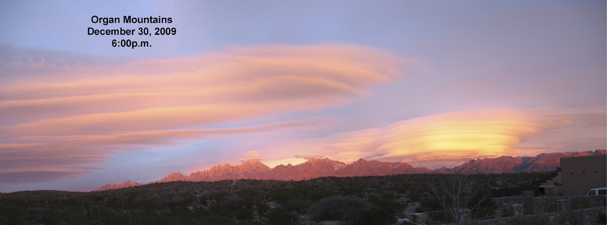
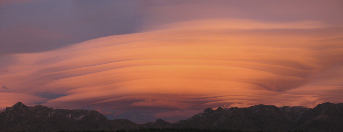
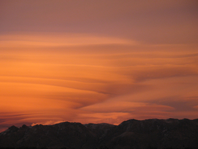
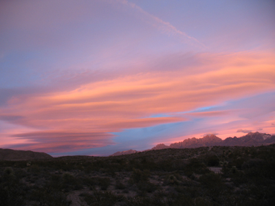
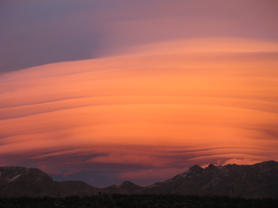
Splender of the Organ Mountains at Sunset
On December 30, 2009, unusual cloud formations appeared over the Organ Mountains around sunset.
Shortly before 5:00 p.m. the clouds transformed into stacked rings, one above the other.
As the sun began to approach the horizon, the clouds turned a reddish hue which proceeded to darken as the sun continued to set.
Within a time span of 20 minutes the glow was out and the skies above the mountains slowly faded into darkness.
From time-to-time the cloud formations above the Organ Mountains take on many different shapes and colors, but none as spectacular as what occurred on the night of December 30, 2009.
Now Playing
Ocotillo Hikers' Slideshows